
India Political Practice Map A4 Size
₹3.00
Description
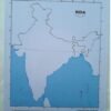
India Political Practice Map
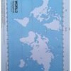
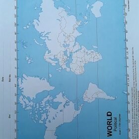
The India Political Practice Map for students is a comprehensive and educational tool designed to enhance students’ understanding of the political geography of India. This map clearly depicts the country’s states and union territories, as well as the capital cities, major cities, and other important political divisions. The map is also color-coded to distinguish between different states and territories, making it easy to understand the political boundaries of the country. The map is laminated for protection and durability, making it an ideal tool for classroom or personal use. With clear labeling and an attractive design, this political map of India is an excellent resource for geography students, as well as for anyone interested in the politics and geography of India. Whether for school projects or for personal reference, this map is an excellent investment for anyone looking to expand their knowledge of India.
Additional information
| Quantity | 1, 5 |
|---|
Only logged in customers who have purchased this product may leave a review.


Reviews
There are no reviews yet.